Nashville Tornado — 3 March

Before sunrise on 3 March, a tornado moved through north and east Nashville, killing at least 9 (as of 9 a.m.). Here are some of the media related to the storm.

https://twitter.com/LuluLady/status/1234757534319357952

This mid-rise building appears to have lost a portion of its roof:

Brick walls go down easily in tornadic winds:

Photo of the tornado:

Radar data from the storm, showing the “debris ball” and tight velocity couplet:

Skew-T proximity sounding for the event from UAH:

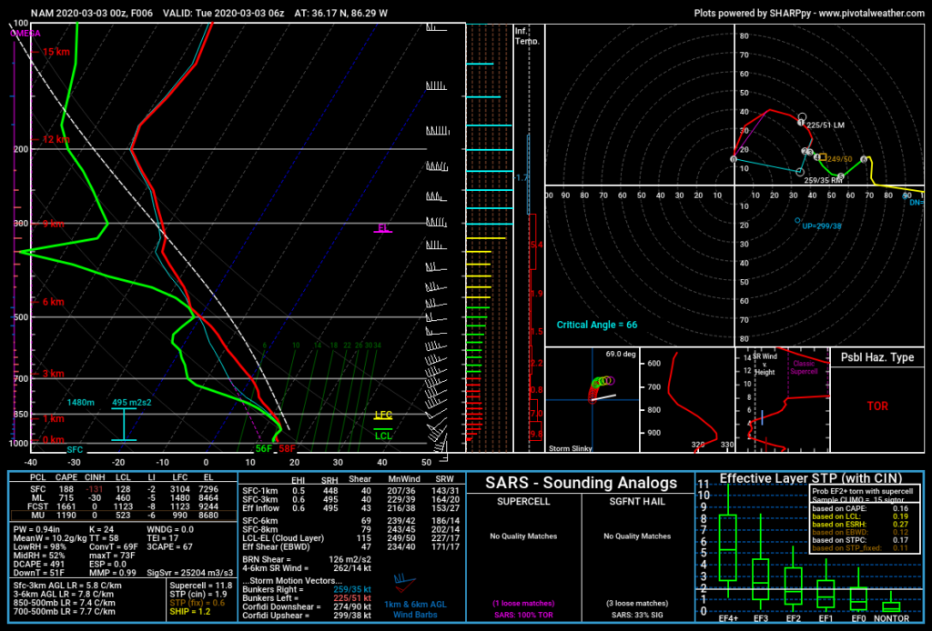
Another one, from the NAM (00 UTC run, 6 h forecast):
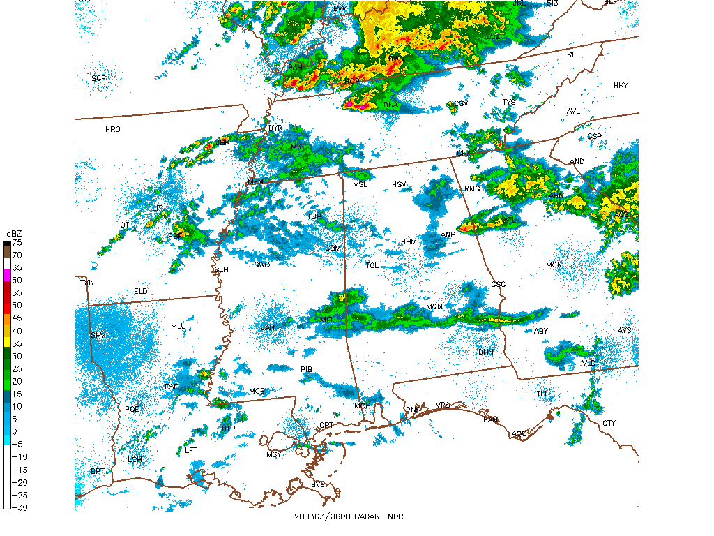
Regional radar and satellite data show that the storm’s inflow was virtually unaffected by any nearby convection:
Watch out for optical illusions — this photo was shared by multiple members of the Nashville “NewsChannel 5” team, including meteorologists:
Hurricane Dorian – Damage

Photographs and videos of damage from Dorian in the Bahamas. I’ll add more as I find them and have time.

https://twitter.com/DavidBegnaud/status/1168536883137306624
https://twitter.com/6INNER/status/1168642796489756673

Hurricane Dorian – Meteorology

Some of the best meteorology-related posts for Hurricane Dorian. More as I go get the links out of my favorites.

Southeast Alabama Tornadoes – 3 March

Numerous fatalities occurred on Sunday, 3 March, as a result of multiple tornadoes in southeast Alabama and southwest Georgia. (Until this message is removed, this post is subject to updates and additions.)

Radar loop of the supercells that developed in advance of the squall line:

Radar loop of the correlation coefficient product, showing the likely path of the the tornado:

A comparison of two proximity soundings — today and last week’s MS/AL event that produced only 4(?) tornadoes:

Trees decimated near Beauregard, Alabama:

An after effect of the tornadoes: closed hospitals.

A breathtaking drone-eye view of the Beauregard tornado, while it was on the ground. Wow!

More coming as I have time to find more links.


Hurricane Michael imagery

Some selected images from Hurricane Michael.  There are many more to add, so I’ll edit this post as I can.

Prior to Landfall

During Landfall

The Eye

https://twitter.com/Basehunters/status/1050088615550877698

https://twitter.com/Basehunters/status/1050721472564609026

Weakening after landfall, as seen on infrared satellite imagery

Damage Photos and Videos

Post-Analysis

https://twitter.com/Wxmanms1/status/1050799077682745346

Why don’t people evacuate?  Here’s a study from Louisiana: https://www.sciencedirect.com/science/article/pii/S2212420917301693#bib8


Florence & Manghkut imagery

Collecting some damage photos and videos for Hurricane Florence and Typhoon Manghkut.

Hurricane Florence

Animated rainfall accumulation map from the NY Times:  https://www.nytimes.com/interactive/2018/09/13/us/hurricane-florence-impact-damage-map.html

Typhoon Manghkut


Big hail near Dallas, April 11

A major hail event occurred in the north suburbs of Dallas on Monday, April 11.  Some media I thought worth saving are captured below.  [Reminders: more than anything, this is archive of images and links that I might use in future classes.  I may add more later, or delete some of these.  If you have any sources that you think complete or improve on this set, please do share.]

Let’s start with the geography of the event:

The Severe Thunderstorm Warning that included Wylie, focus of some of the videos below:


Videos

Slow-motion video of baseball or softball hail crashing into a pool:

Additional good ones:


Photos

I don’t know how big this person’s hand is, but does it really matter?

Additional good ones:

Meteorology

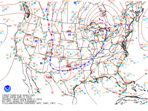
  • The focusing mechanism for convection: a surface low, frontal boundary and dryline.  The WPC’s surface analysis at 1800 UTC:
    namussfc2016041118
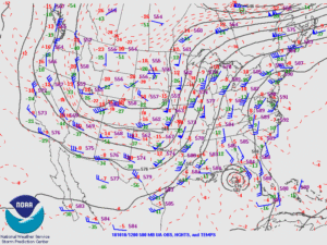
  • The full complement of upper air charts for 1200 UTC (11th) and 0000 UTC (12th) is available via the Storm Prediction Center’s archive.
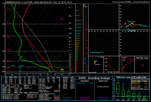
  • A 9-h forecast sounding from the 4km NAM for 2100 UTC (model initialized at 1200 UTC).  Over 3000 J/kg of CAPE, no matter how you calculate it!
    nam4km_2016041112_009_32.91--96.14
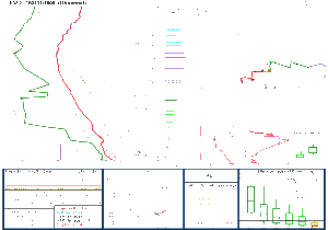
  • And if model soundings aren’t your thing, the observed, pre-event FWD sounding at 1800 UTC.  But note that in this case, there’s a 2500 J/kg difference between surface-based and mixed-layer CAPE; the high surface dewpoint may be anomalous.
    FWD
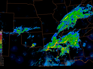
  • A regional radar loop that honestly isn’t that breathtaking, but illustrates the isolated supercell nature of this hail producer.
    dfw_hail
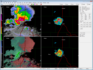
  • At one point, about 2200 UTC, the storm had a textbook high-precipitation supercell look.  Upper left and color bar: reflectivity at the lowest elevation angle.  Lower left: storm-relative velocity.  Upper-right: VIL (the scale maxes out at 80 kg/m2, but I found a value of 121!!!).  Lower right: radar-estimated maximum hail size, with one pixel indicating 2.98-inch size.  Probably one too many significant figures there, but I digress.
    kfws_20160411_2202

Images and data from November 16

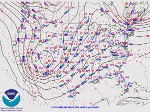
The rare November tornadoes in western Kansas provided some breathtaking photography and great meteorology.  As I’ve said before, one purpose of this “blog” is to keep some of that information together for posterity’s sake and for future classes.  If there’s anything you think would make a nice addition, send it on.

NWS survey photos and damage tracks:  http://www.weather.gov/ddc/TornadoOutbreak2015Nov16

Recap from US Tornadoes website, emphasizing the rarity of a November tornado event in the Plains

USA Today’s story has a superb collection of Twitter-linked photos from the day

Springtime in November” brief summary from Jeff Masters, including a couple of links

Story from the Hays Post, of people complaining about the lack of sirens even when they were being warned via text message (sighhhhh)

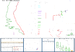
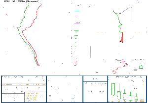
Sorry about the sounding diagrams below — they display correctly at full resolution, but they have a transparent background so the thumbnails look garbled.

DDC

DNR

500_151117_00

namussfc2015111621

Throwing out the record books?

I’ve tweeted about that phrase a lot this week.  “It’s a rivalry game, so throw out the record books!” and all its variations, in most cases, couldn’t be further from the truth.

Records of the favored team in rivalry games since 1995 are shown below; lines and results are from Odds Shark.

  • Alabama/Auburn 15-4
  • Baylor/TCU 6-3
  • Clemson/South Carolina 15-4
  • Florida/Florida State 16-3
  • Georgia/Georgia Tech 12-7
  • Indiana/Purdue 17-2
  • Michigan/Ohio State 15-4
  • Michigan State/Penn State 11-4
  • Minnesota/Wisconsin 17-2
  • Notre Dame/USC 14-6
  • Oklahoma/Oklahoma State 13-6
  • UCLA/USC 13-6

All games are alphabetical, just so no one gets peeved.  🙂  The favored teams have the worst results in Baylor/TCU, which may be because they’ve only played 9 times in those 20 years.  For all the others, it is overwhelmingly true — on average 75 percent of the time — that the favored team wins.

(Disclaimer: results from this year are not included, since I just decided to do the post today.  I’ll update it between now and next year.)